
Archivo:California 60.svg

Tamaño de esta previsualización PNG del archivo SVG: 385 × 401 píxeles. Otras resoluciones: 230 × 240 píxeles · 461 × 480 píxeles · 737 × 768 píxeles · 983 × 1024 píxeles · 1966 × 2048 píxeles.
Ver la imagen en su resolución original ((Imagen SVG, nominalmente 385 × 401 pixels, tamaño de archivo: 14 kB))
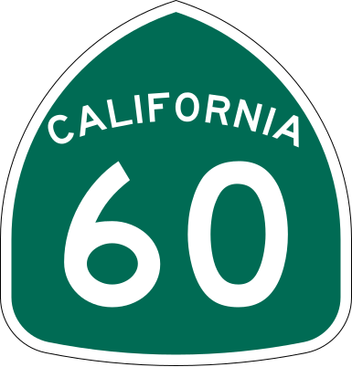
| Descripción | Vector image of a 24 in by 25 in (600 mm by 635 mm) California State Route shield. Colors are from [1] (Pantone Green 342), converted to RGB by [2]. The outside border has a width of 1 (1/16 in) and a color of black so it shows up; in reality, signs have no outside border. |
| Fecha | |
| Fuente | Made to the specifications of the 1971 Caltrans sign drawing (still in use). Uses the Roadgeek 2005 fonts. (United States law does not permit the copyrighting of typeface designs, and the fonts are meant to be copies of a U.S. Government-produced work anyway.) |
| Autor | SPUI |
| Otras versiones |
Esta imagen vectorial incluye elementos que han sido tomados o adaptados de esta: |
| SVG desarrollo | El código fuente de esta imagen SVG es válido. Este logotipo fue creado con Adobe Illustrator |
This file is in the public domain because it comes from the California Manual on Uniform Traffic Control Devices, sign number G28-2 (CA), which states specifically in its introduction, on page 44 that:
|
Historial del archivo
Haz clic sobre una fecha y hora para ver el archivo tal como apareció en ese momento.
| Fecha y hora | Miniatura | Dimensiones | Usuario | Comentario | |
|---|---|---|---|---|---|
| actual | 16:31 20 mar 2006 | | 385 × 401 (14 kB) | SPUI~commonswiki | |
| 13:56 20 mar 2006 |  | 385 × 401 (13 kB) | SPUI~commonswiki | ||
| 13:30 20 mar 2006 | 570 × 2910 (24 kB) | SPUI~commonswiki | {{spuiother}} 24 in by 25 in (600 mm by 635 mm) California State Route shield, made to the specifications of the [http://www.dot.ca.gov/hq/traffops/signtech/signdel/specs/G28-2.pdf 1971 Caltrans sign drawing] (still in use). Uses the [http://www.triskele. |
Usos del archivo
Las siguientes páginas usan este archivo:
- Autopista Santa Ana
- Condado de Los Ángeles
- Condado de Riverside
- Condado de San Bernardino
- East Los Angeles Interchange
- Interestatal 10 en California
- Interestatal 215 (California)
- Interestatal 5 en California
- Interestatal 605
- Interestatal 710
- Línea L (Metro de Los Ángeles)
- Ruta Estatal de California 19
- Ruta Estatal de California 57
- Ruta Estatal de California 59
- Ruta Estatal de California 60
- Ruta Estatal de California 61
- Ruta Estatal de California 71
- Ruta Estatal de California 83
- Ruta Estatal de California 91
- Sur de California
- U.S. Route 101 (California)
- Wikiproyecto:Estados Unidos/Carreteras/CA
- Anexo:Carreteras estatales de California
Uso global del archivo
Las wikis siguientes utilizan este archivo:
- Uso en azb.wikipedia.org
- Uso en az.wikipedia.org
- Uso en ca.wikipedia.org
- Uso en de.wikipedia.org
- Uso en en.wikipedia.org
- U.S. Route 101
- Los Angeles County, California
- San Bernardino County, California
- Greater Los Angeles
- Interstate 10
- Pomona, California
- Interstate 605
- California State Route 91
- Arroyo Seco Parkway
- Interstate 110 and State Route 110 (California)
- Interstate 710 and State Route 710 (California)
- California State Route 57
- Santa Ana Freeway
- Hollywood Freeway
- Interstate 215 (California)
- Santa Ana River
- California State Route 60
- East Los Angeles Interchange
- San Gabriel River (California)
- Four Level Interchange
- Transportation in Los Angeles
- Southern California freeways
- California State Route 39
- California State Route 61
- Eastern California
- California State Route 71
- California State Route 19
- L Line (Los Angeles Metro)
- E Line (Los Angeles Metro)
- Wikipedia:WikiProject U.S. Roads/Redirects/California
- San Bernardino Valley
- California State Route 59
- California State Route 83
- U.S. Route 101 in California
- Interstate 10 in California
- Atlantic Boulevard (Los Angeles County)
- Interstate 15 in California
- List of highways numbered 60
- Interstate 5 in California
- List of state highways in California
- Template:L Line (Los Angeles Metro)
- Template:E Line (Los Angeles Metro)
- Transportation in the Inland Empire
Ver más uso global de este archivo.