Usuario:Hispalois/mapas antiguos
Apariencia
Muy buen sitio sobre mapas antiguos: Cartographic Images
Precolombinos
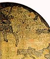
[editar]Mapa Mundi Hereford, c. 1300
[editar]Mapa de Dulcert, 1339
[editar]Mapa Mundi, Kangnido, c. 1402
[editar]
 Details of Africa, Europe and the Middle East
![]()
Carta Náutica de 1424 (llamada de Pizzigano)
[editar]- The 1424 Nautical Chart en el sitio de la Universidad de Minnesota
- Primer artículo escrito tras el descubrimiento de esta carta: CORTESAO, Armando (1953). «The North Atlantic Nautical Chart of 1424». Imago Mundi. Vol. 10, pp. 1-13 (1953). ISSN 03085694.
Mapa Mundi Fra Mauro, c. 1459
[editar]-
Overview (inverted, South is normally at the top)
-
Part of Africa
-
Spain, Portugal and Northern Africa
-
Europe
-
Middle East
-
Part of China
-
Japan detail
-
Comparison with Fra Mauro map
Portulano de Roselli, 1466
[editar]- The 1466 Portolan Chart en el sitio de la Universidad de Minnesota
Pedro Reinel, 1485
[editar]-
Portulano del portugués Pedro Reinel, ca. 1485
Portulano de Canepa, 1489
[editar]- The 1489 Portolan Chart en el sitio de la Universidad de Minnesota
Mapas Mundi 1492-1560
[editar]-
Cantino (pequeño)
-
De la Cosa, 1500
-
Mapa mundi, por Pedro de Medina & G.B. Pedrazano, 1554
-
Waldseemüller, 1507
Caverio en la BNF:[1]
Artículo de Paladini Cuadrado sobre la evolución de la cartografía en estos años: [2]
Américas
[editar]-
Mapa de América por Sebastian Munster. 1551
-
Mapa de América por Giovanni Battista Ramusio. (1565)
-
Mapa de América. Cartógrafo: Jodocus Hondius. C. 1640.
-
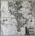
Mapa de América. Ca. 1770
-
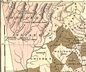
Historical map of the USA, Mexico and Central-America
-
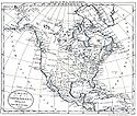
Map of North and South America, French (18th century)
-
Mapa geographica completens Indiae Occidentalis
América del norte
[editar]América Central
[editar]-
Jamaica (1817)
-
Central America (1860)
América del Sur
[editar]- Generales
-
Girolamo Ruscelli (1562)
-
Robert de Vaugondy (1750)
- Por zonas
-
Virreinato del Perú. Cornelius van Wytfliet. Lovaina, 1597
-
Virreinato del Perú, Florida y el Lado Este de la Península de Yucatán (Ambos bajo la administración del Virreinato de Nueva España). Abraham Ortelius, Amberes, 1608
Territorios del Atlántico
[editar]-
Africa Occidental e islas, 1738
Azores
[editar]-
Azores, 1584
Cabo Verde
[editar]-
Islas de Cabo Verde, 1888
Guinea
[editar]-
Africa Occidental, 1561. Aparece "La Mina".
-
Guinea y Sto. Tomé, 1612
-
Negroland and Guinea, 1729
-
Golfo de Guinea, 1888
Marruecos
[editar]-
Marruecos, 1830


